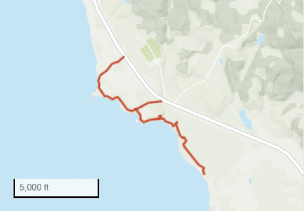
Featured Hike: Atkinson Bluff Trail
A seaside-to-sand dunes journey in this ocean-to-ridgeline treasure
Length
2.9 miles
Rated
Easy*
Trail Type
Loop
Elevation Gain
36 feet
With a mix of easy looping seaside trails and more challenging adventures along cliffs and into dunes, Atkinson Bluff Trail offers something for everyone.
Although rated “easy” by California State Parks, this trail is as long as a 2.9-mile looping trail with shorter loops available and access to dunes for the more adventurous. A seaside treat, it also features expansive inland views of forests and cliffs.
*Trail ratings vary and in this guide you will find information to make the best choice for your health and wellness goals.

Enjoy the health benefits of time in nature on the Atkinson Bluff Trail at Año Nuevo State Park in the Santa Cruz mountains.

Why is this a healthful experience?
Whitehouse Ridge Trail to Upper Vista Point
NOTE: This trail is currently closed due to damage from the CZU Fire. Here is an alternative hike in Año Nuevo State Park.
Although Año Nuevo State Park is well-known for viewing one of the world’s largest populations of northern elephant seals, the view from it’s Upper Vista Point includes breathtaking scenery from the coastal plains to a historic lighthouse and the Pacific Ocean beyond. The Whitehouse Ridge Trail to Upper Vista Point is a vigorous 1.2-mile uphill hike, almost 2.5-miles roundtrip. To begin your hike, find the signpost for the Whitehouse Ridge Trail 2.4 miles east of Highway 1 along Whitehouse Road within Año Nuevo State Park. The steep trail leads directly into dense fern-covered redwood forests. At 1.2 miles you will reach the Upper Vista Point. You may be tempted to turn off at the lower elevation vista point about .5 mile from the trailhead but if you can make it to the upper lookout, it’s well worth the effort. Once there, look westward for beautiful views of the coastal plain at Año Nuevo, the Pacific Ocean and Pigeon Point Lighthouse. Look northwest and you’ll see the upper Whitehouse Creek watershed where Sempervirens Fund is currently working to protect redwood forests and extend the connection between Año Nuevo and Big Basin Redwoods State Parks.

Plan Your Hike
Address: Año Nuevo State Park, Highway 1 at New Years Creek Road 20 Miles North of Santa Cruz, Pescadero, CA 94060
Hours: The park is open for day use from 8:30 am to sunset daily.
Directions: click here for Google maps directions
Park Activities
- Hiking
- Nature & Wildlife Viewing
- Guided Tours
Park Amenities
- Picnic Areas
- Marine Education Center
- Natural History Exhibit
- Bookstore
- Theater
Volunteer
Throughout the year, Sempervirens Fund holds a variety of volunteer events, including invasive species removal, trail clean ups, and more! Check out our Volunteer Page for more information.
More to Explore
- Learn more about Año Nuevo State Park
- Visit the official Año Nuevo State Park website
- Whitehouse Ridge Trail Map
- Find more redwood activities
- Find Volunteer opportunities at the park

