Accessibility in the Santa Cruz Mountains
photos by Ian Bornarth.
4 Wheel Bob
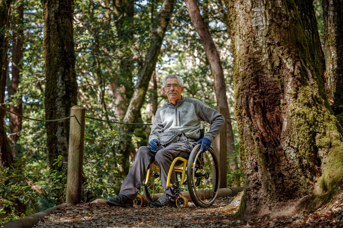
Bob Coomber’s adventures, notably to Kearsarge Pass in the southern Sierra Nevada where he had to stop every 5-10 feet to maneuver trail obstacles, have been well documented by the media including the award-winning documentary “4 Wheel Bob” and a Backpacker Magazine article titled “Hell on Wheels”. But long before all of that, his epic journey began when the former Oakland Police Officer had to pivot to maintain his love of hiking when diabetes necessitated the use of a wheelchair. He began his foray back into the natural world with paved paths like Livermore’s Sycamore Grove Park but yearned to go further and see more.
Progress Not Perfection
His next hiking chapter began when he drove to Morgan Territory Regional Preserve southeast of Mount Diablo in the East Bay and almost didn’t get out of his car because the trail looked so dauntingly steep. But he did. Because it was something he really wanted to do and he was determined to try. That was when he decided on what he now calls his first rule, “If you’re pushing and the chair is going in the right direction, keep going.”
The Right Stuff
Bob quickly realized that the standard issue folding wheelchair he got from the hospital was not up to the task. While he navigated the hills and rocks of the terrain swelling toward the mountain one broke in half while he used it right on the trail. This brought Bob to his second rule: find sturdy equipment, such as his rigid framed trail chair with full suspension and knobby-tires for downhill traction fitted specially for him, and make sure you are comfortable in it because conditions can get far less comfortable on the trail. Because Bob exerts much more physical effort and can take more time than a typical hiker on the trail, he approaches most hikes more like a backpacking trip. Finding the right backpack for extra water and food that is lightweight, doesn’t have a frame, and will fit over his wheelchair between the wheels is essential. Bob also recommends getting equipment with warranties whenever possible since sometimes even specialized items for specific recreation types, weather, or needs don’t always work out.
Access
Once Bob found a local company to size a wheelchair specific to his measurements and outfit it for the trail, he was able to push further and further from Morgan Territory and up toward the looming mountain. His solitary quiet, patience, and determination were rewarded with many beautiful scenes and wildlife encounters just for him.
On one such hike, he first met the former East Bay Regional Park District Executive Director Bob Doyle who was leading a hike group, and the connection led to Bob advising on accessibility challenges he’d experienced in some parks. Bob would arrive at a park, park in a handicapped parking space with room to get in and out of his wheelchair, and quick access to a trail head only to find that he could park but he couldn’t get into the park. Many gates at trail heads have latches that are too high for people utilizing wheelchairs to reach but thanks to Bob, that’s been changing slowly over the decades thanks to the same patience, positivity, and determination he brings to the trail.
Although access in parks is largely improving, there is still so much room for growth. Bob has experienced being referred to as a “wheelchair” rather than a person in a wheelchair, and he has consistently had his views completely blocked—even on well-intentioned accessible trails and platforms—by railing right at his line of sight. “I’m not particularly fond of some Americans with Disabilities Act guidelines because they can be limiting, like that’s all someone can or should do—very short trails. Public agencies have to use the guidelines but I want a more natural experience. You may find it's not as daunting as you think.”
Reconnecting with Redwoods
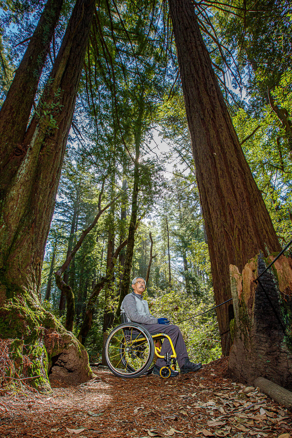
As Bob gained more hiking experience with his wheelchair, he turned his sights to more parks including the redwoods of the Santa Cruz mountains that he explored in his youth from his grandmother’s cabin on Zayante Road outside of Felton where the sun barely stood a chance of reaching the forest floor’s unique bugs and salamanders sheltered by the dense canopy above. “I’ve always been impressed with redwoods’ ability to grow so old and overcome challenges. They have developed a system of surviving. As a boy, I used to marvel at how they’ve gotten so good at it when they can’t even move.” Perhaps redwoods lent an inspirational pillar at a young age in Bob’s mindset to approach challenges positively and to make the day what he wants of it.
Hard-Learned Hiking Tips
His list of hard-learned hiking tips tailor to each trail but here are some suggestions for aspiring hikers in the redwoods:
- Bring rain gear and wet weather shoes – it’s often moist in the redwoods, keep in mind you’re going to a temperate rainforest.
- Consider waterproof gloves if you’ll need to hold onto equipment – Bob has found neoprene diving gloves keep his hands warm and help to protect them since they act as his brakes for his wheelchair when going downhill. He brings 2-3 pairs on trips.
- Find equipment that fits you and what you want to do – it’s worth the time to find something that is measured to you so you’re comfortable when you use it. Also ensure that it has a warranty in case it doesn’t work out as intended.
- Bring a compass and map – cell service in the redwoods can be spotty at best, bring navigational tools just in case.
- Bring water – expect to need more than a typical hiker because it may take more time and effort. Bob likes to bring a three-liter water pouch.
- Bring food – bring things you’ll actually want to eat because you will likely use more energy than a typical hiker and think like a backpacker in terms of things that won’t spoil and don’t weigh too much.
With all of his experience, Bob has determined questions to help him consider if a trail is the right fit for what he’s looking for and what equipment and supplies he’ll need. “How long will it be? How far can it go? I like trails that can go a long way or have lots of options with connections to other trails.”
Enjoying new challenges, he prefers trails he’s never been on. But he’s learned there are some challenges that require him to be more prepared and determined, and he may choose trails without lots of loose rock, like often occur in the high country that can be too slippery, sometimes veering from challenging to unsafe. But one common piece of trail information Bob doesn’t like to consider is elevation gain and loss. “I find elevation gain and loss can be discouraging. If I want to hike a trail, I just try it. I’ve found it may not be so hard as it seems.”
Choose Your Own Adventure
So, whether you choose to visit the redwoods on accessible trails or venture a little further into nature and its challenges, Bob says there’s no bad day in the redwoods. “You have to go find out what your limits are. You’ll never know what’s right for you until you try. Some things may be more difficult but you’ll find ways to work around it.”
- If you’d like to consider traditional trails in the forest, check out our Top 10 Redwood Hikes.
- To gain some of the benefits of redwoods when you can’t visit in person, we’ll bring the Virtual Redwoods to you.
- For those looking for accessible trails, we’ve gathered all the accessible trails in the Santa Cruz mountains:
Accessible Trails in the Santa Cruz Mountains
Año Nuevo State Park
Trail: Año Nuevo Point Trail
Type: out-and back, compacted soil
Length: 1.3 miles each way
Highlights: In addition to spectacular views from the coastal bluffs of the beaches and wildlife with four overlooks for viewing of the world’s largest population of northern elephant seals, you can see some of the only native stands of the threatened Monterey pine from this trail.
Note: A portion of this trail is restricted to guided tour only during the breeding season.
Año Nuevo State Park
Trail: The Equal Access Boardwalk Trail
Type: boardwalk
Length: 0.27 miles each way
Highlights: Traverse over sand dunes and coastal scrub plants along the beach to an observation deck to view the northern elephant seals.
Note: Access to this trail is restricted to guided tour only during the breeding season from April 1st to November 30th when Equal Access tours are organized every other Saturday. Transportation from the parking lot to the trail can be arranged with reservations. Read more about Año Nuevo State Park
Arana Gulch Open Space
Trail: Arana Gulch Multi-Use Trail
Type: ADA-compliant, pervious concrete
Length: 1 mile loop
Highlights: An excellent place for birding and wildflower viewing—including the rare, endemic Santa Cruz tarplant, the path loops through stands of live oak, coastal terrace prairie, and wetlands.
Note: Hikers recommend starting at the Frederick Street entrance to experience the full stretch.
photo by Richard Masoner/Cyclelicious
Bear Creek Redwoods
Trail: Upper Lake Loop Trail
Type: accessible pathway close to the parking lot
Length: 0.2 miles each way
Highlights: From this trail around the lake you’ll see habitat restoration sites and historical artifacts like Ohlone mortars.
Note: You can download an Interpretive Map for a self-guided tour.
photo by Don DeBold
Castle Rock State Park
Trail: Whole Access Trail
Type: ADA accessible trail
Length: about 0.08 miles each way long
Highlights: This trail leads you to an outstanding vista from the crest of the Santa Cruz mountains.
Note: You can pack a picnic to enjoy the views from the accessible tables at the end of the trail. Read more about Castle Rock State Park.
Castle Rock State Park
Trail: Castle Rock Trail
Type: ADA accessible trail, pervious pavement
Length: 0.08 miles
Highlights: From the new Robert C. Kirkwood Entrance to the park, the northernmost portion of the Castle Rock Trail is accessible and loops around the native plants garden tended by the Amah Mutsun Land Trust and the Muwekma Ohlone Tribe illustrates how Native Americans used local plants for medicinal and other purposes.
Note: Picnic tables are accessible along the loop as is the amphitheater at the entrance if you’d like higher perspective of the forest.
photo by Russell Ferretti-Hoyle
El Corte de Madera Creek Open Space Preserve
Trail: Sierra Morena Trail
Type: Easy access designated
Length: 0.6 miles out and back
Highlights: A shady trail through a lush mixed evergreen forest with glimpses between trees to the canyon below and a view from the meadow just south of Gordon Mill.
Note: This trail is narrow and popular with mountain bikers. Read more about El Corte de Madera Creek Open Space Preserve.
photo by jordanpattern
Forest of Nisene Marks State Park
Trail: Waggoner Overlook Trail
Type: gravel, hardened surface ADA path, typically at least 6 feet wide, gentle 3% or less grade
Length: 0.3 miles out and back
Highlights: Soak in the beauty and solitude beneath the canopy of a second-growth redwood forest, described as “balm to the soul” by Hilltromper, on your way to overlook Aptos Creek from a wooden viewing platform with an accessible picnic table.
Note: There are two designated van-accessible spaces in the paved parking lot off of Aptos Creek Fire Road at the south end of the trail.
photo by Vallie
Henry Cowell Redwoods State Park
Trail: Meadow Trail
Type: ADA accessible for 0.5 miles
Length: 0.5 miles
Highlights: This trail will take you past sycamore trees and box elders along a meadow where deer, coyotes and birds can often be spotted especially around dusk and dawn.
Note: Designated spots in the main parking lot and the gift shop are accessible and accessible restrooms are available in the campground near site #22. Read more about Henry Cowell Redwoods State Park.
photo by fredhochstaedter
Henry Cowell Redwoods State Park
Trails: Meadow Trail to River Trail
Type: ADA accessible trail sections
Length: about 1 mile
Highlights: Travel through redwoods to the San Lorenzo River, the largest river in the Santa Cruz mountains providing crucial water for the forest and habitat for wildlife.
Note: From the main parking lot take the accessible section of Meadow Trail trailhead for 0.2 miles to the popular River Trail, accessible for 0.75 miles.
photo by Jim Bahn
Henry Cowell Redwoods State Park
Trail: Redwood Loop Interpretive Trail
Type: ADA flat trail for 0.75 of the full 0.8 mile loop, partial railings
Length: 0.75 miles
Highlights: A visit to this ancient redwood grove, by photographer Andrew P. Hill, more than a century ago reportedly helped launch the Sempervirens Club (now, yours truly) and the redwood preservation movement. Keep an eye out for bright yellow banana slugs, a rare ghost redwood, and marvel at the historic, resilient, living Fremont Tree’s large hollowed out base.
Note: An audio version of the interpretive stops along the trail can be downloaded here and a printed guide to the interpretive signs is available here and in the gift shop.
photo by Ken Lund
Monte Bello Open Space Preserve
Trail: Stevens Creek Nature Trail
Type: not officially easy-access designated, gently sloping, 5% grade or less
Length: 500 feet each way
Highlights: The trail leads to a stone bench and views of Stevens Creek Canyon, Mount Umunhum, and Loma Prieta which was the epicenter of the 1989 earthquake.
Note: The full loop is 3-miles and after the vista point descends 450 feet.
photo by Bob Gorman
Natural Bridges State Beach
Trail: Monarch Trail
Type: ADA-compliant boardwalk
Length: 0.26 miles there and back
Highlights: Follow the boardwalk dotted with eye-level interpretive signs to see thousands of slumbering monarch butterflies sleep the winter away on the eucalyptus trees of Monarch Grove, typically between mid-October and mid-February. During the rest of the year, enjoy looking over the iconic beach and Pacific from the viewing platform near the entrance station.
Note: Beach wheelchairs are available for further exploration. Call (831) 423-4609 for information.
photo by Lee Jaffee
Neary Lagoon Open Space Park
Trail: Neary Lagoon Boardwalk
Type: floating boardwalk and hardened earth wheelchair-accessible path
Length: about 1 mile
Highlights: Float above the wetland wildlife sanctuary, great for birding and spotting turtles, amidst the marsh’s tulles and cattails just a half-mile from downtown Santa Cruz. Along the way, interpretive signs will detail the marsh and lagoon’s wildlife, local flora, and the Indigenous Ohlone People of the area.
Note: Hikers suggest the entrance at the end of Chestnut Street.
photo by finch
Pescadero Marsh Natural Preserve, Pescadero State Beach
Trail: Butano Trail
Type: moderately firm fire road and dirt trail, typically 4 feet wide, slight hill
Length: Less than 1 mile, out and back
Highlights: If you want to be near the water and bird watch, Access Northern California says the bumpy trail may be worth it. The marsh has hosted more than 200 bird species, at least 60 of which nest there. This trail will take you right up to Butano Creek (and an inaccessible bridge) where you may spot great blue herons, great egrets, double-crested cormorants, or even endangered California red-legged frogs, Coho salmon, and steelhead trout.
Note: This trail is not recommended for those sensitive to rough terrain, nor in wet weather due to mud.
photo by Allie_Caulfield
Pulgas Ridge Open Space Preserve
Trail: Cordilleras Trail
Type: easy access designated
Length: 0.8 miles
Highlights: After the trail breaks away from a parallel service road, it leads to Cordilleras Creek and a peaceful wooded valley with a bench.
photo by Michael Morgan
Purisima Creek Redwoods Open Space Preserve
Trail: Redwood Trail
Type: easy access designated, compacted soil
Length: 0.25 miles each way
Highlights: You’ll be greeted by tall redwoods and fresh air crisp off the nearby Pacific as soon as you hit the trail.
Note: You’ll find three accessible picnic tables and an accessible pit toilet on the trail.
photo by Ian Bornarth
Purisima Creek Redwoods Open Space Preserve
Trail: Purisima Creek Trail
Type: easy access designated
Length: 1 mile each way
Highlights: This old logging road follows Purisima Creek through redwood groves and open meadows to views of the Pacific Ocean.
Note: This trail is considered “moderately accessible” with short sections where the grade is 10-15% and the trail can be muddy after rain.
photo by Sarah Dinu
Rancho San Antonio Open Space Preserve
Trail: Permanente Creek Trail to Service Road to Rogue Valley Trail
Type: wide dirt trail, paved road
Length: 1 mile each way
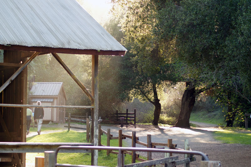
Highlights: One of Wheelchair Travelling’s favorite accessible hikes in the San Francisco Bay Area, the Service Road goes to Rogue Valley Trail and Deer Hollow Farm which is a working farm in the preserve with an organic garden, historic ranch buildings, and many animals.
Note: You can obtain a permit for the permit-only parking lot 0.4 miles from Deer Hollow Farm by calling ahead if you have a disabled person parking placard.
photo by Martin Jambon
Ravenswood Open Space Preserve
Trail: Ravenswood Trail (a section of the Bay Trail)
Type: raised boardwalk, paved
Length: 1.9 miles
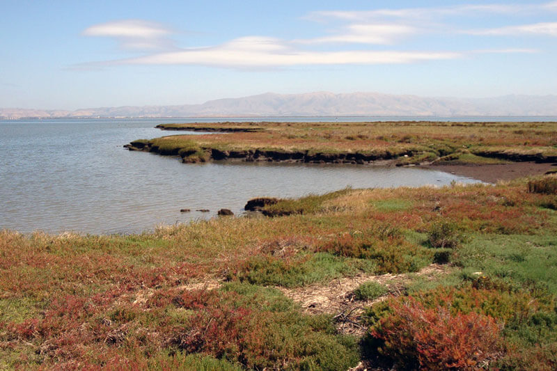
Highlights: All trails are designated as easy access trails in this preserve but the Ravenswood Trail is level with great views of the bay and excellent bird watching including American avocets, herons, egrets, ducks, sandpipers, and migrating birds.
Notes: Accessible parking spaces, picnic tables, and restrooms are available at Cooley Landing. Hikers have mentioned experiencing airplane noise from the local airport but the birdwatching opportunities outweighed it.
photo by MilnerMac
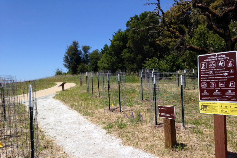
Russian Ridge Open Space Preserve
Trail: Audrey’s Way
Type: paved path, wheelchair accessible terrace
Length: 300 feet
Highlights: At the end of the paved path leading to the Audrey C. Rust Commemorative Site, you’ll find a wheelchair-accessible terrace with a bench offers sweeping views out to the ocean.
Note: Park at Russian Ridge’s Mindego Gateway Lot.
photo by Steven Woo
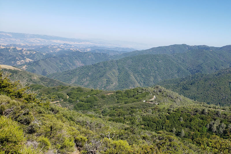
Sierra Azul Open Space Preserve
Trails: Mount Umunhum Summit pathways - west Summit, ceremonial circle, east Summit
Type: ADA accessible pathways
Length: 0.3 miles
Highlights: You can enjoy interpretive signs and breathtaking 360-degree views of the Santa Cruz mountains, San Francisco, Monterey Bay, the Pacific Ocean, and the Sierras on clear days from ADA-accessible viewpoints along the route.
Note: The ADA standard paths are also considered well suited families with young children and the elderly.
photo by az3
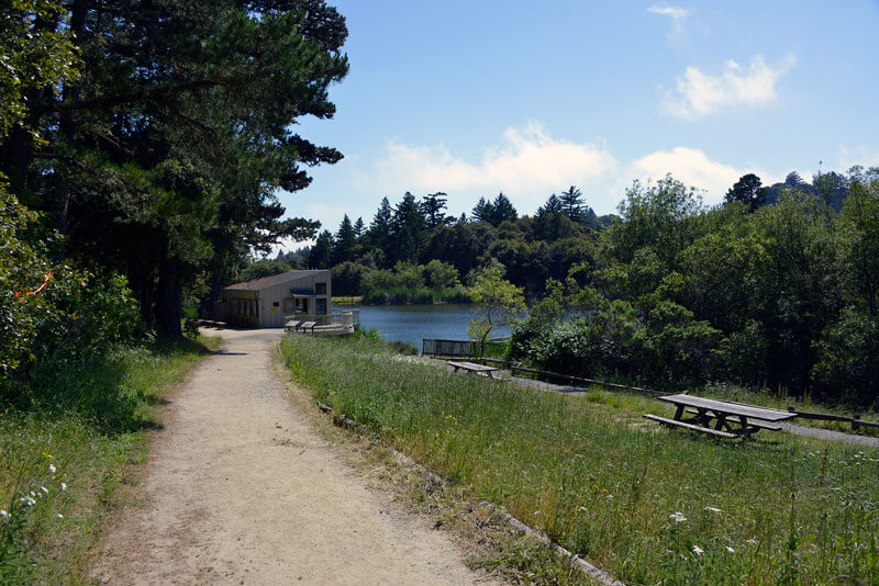
Skyline Ridge Open Space Preserve
Trail: Alpine Pond Loop
Type: packed dirt or gravel, wooden bridges, typically at least 3 feet wide, slopes 5% grade or less
Length: 0.5 miles
Highlights: The smooth, level trail around Alpine Pond has a wheelchair-accessible viewing scope and floating pier for observing wildlife but if you don’t, try the adjacent David C. Daniels Nature Center.
Note: Park at the unpaved Russian Ridge parking lot and go through the pedestrian tunnel to the pond and Nature Center.
photo by Ray Cowan
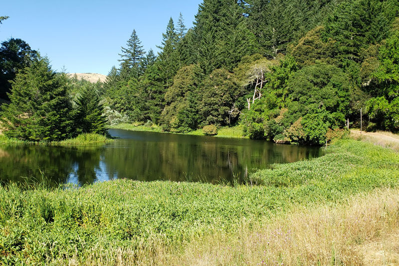
Skyline Ridge Open Space Preserve
Trails: Horseshoe Lake via Ridge, Horseshoe Lake, and Horseshoe Loop Trails
Type: paved and unpaved, gentle grade
Length: 0.25 miles
Highlights: Hugging the lake, the trails provide a more rural experience and great views.
Note: An unpaved, designated lot allows closer access to Horseshoe Lake for visitors with a disabled person parking placard.
photo by az3
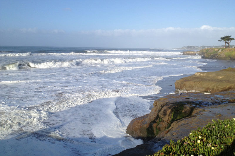
West Cliff Drive
Trail: West Cliff Drive Bicycle Path
Type: paved, partial edge barriers and railings, typically at least 4 feet wide, gentle grades of 5% or less, although there is a steep hill between the path and the Boardwalk
Length: 3.4 miles each way
Highlights: Between the road and the beach, this path hugs the coast line between Natural Bridges State Beach and the Santa Cruz Boardwalk providing great views of the ocean and potential wildlife viewing including sea lions, sea otters, seals, pelicans, cormorants, and whales and dolphins are often seen in the summer.
Note: Wheelchair-accessible bathrooms and designated parking spaces are available near the lighthouse and Cowell Beach on West Cliff Drive. Designated accessible parking spaces are also available in the lot before the Natural Bridges State Park entrance.
photo by fogcat5
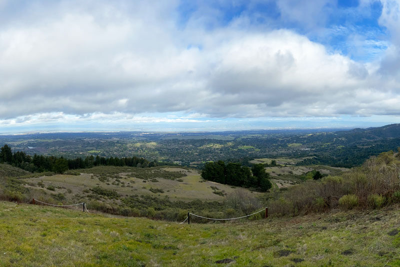
Windy Hill Open Space Preserve
Trail: Anniversary Trail
Type: easy access designated
Length: 200 feet
Highlights: The trail leads to a point with views of Portola Valley, Stanford and even Mount Diablo.
Note: You can lengthen your hike into an approximately one-mile loop by returning to the parking lot via the disc track along Skyline Boulevard.
photo by btwashburn
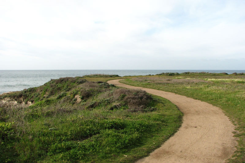
Wilder Ranch State Park
Trail: Old Cove Landing Trail
Type: packed natural surface but can be rutted from bike tires, typically 8 feet wide, 5% grade or less, two railroad crossings
Length: about a 3 miles loop
Highlights: Follow the bluffs for views of wetlands and a protected beach preserve where thousands of birds can often be seen including snowy plover, pelicans, seagulls, and geese. You may even hear passing sea lions or spot migrating whales.
Note: Hikers have noted all-terrain tires or motorized equipment may be needed.
photo by sgrace
More to Explore
Accessibility to nature has many facets. Although we didn’t find any official braille trails for the visually impaired in the Santa Cruz mountains region, Nature For All’s trail directory includes trails throughout the state, country, and world. There are also several local organizations that specialize in accessible outdoor recreation and adventures including Shared Adventures in Santa Cruz, Bay Area Outreach and Recreation Program (BORP) in Berkeley, and Environmental Traveling Companions (ETC) in San Francisco.
- Read more about how redwoods improve our health
- Check out our Wildflowers After Wildfire guide for great hikes to see rare plants
- Read more about how we work to provide access to Nature For All

