Redwoods and Climate Part 4
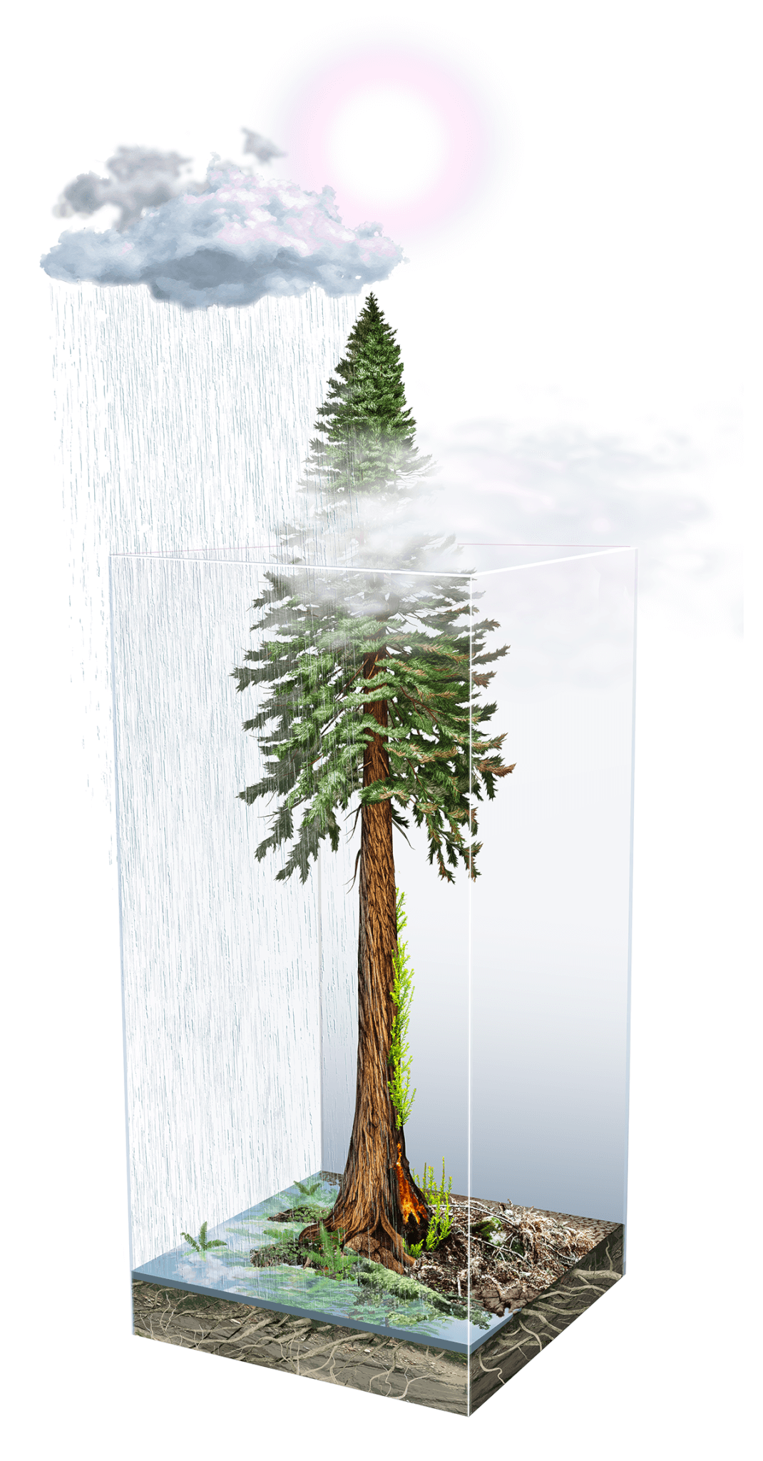
Impact of climate on redwoods by Ink Dwell studio
The Impacts of Climate on Redwoods: Part 4
Cut by deep valleys, cooled by the sea breeze, and draped in fog, the Santa Cruz mountains are a southern stronghold for California’s coast redwoods. The range’s oldest trees have withstood nearly two millennia of drought, floods, winds, fires, earthquakes, and changes made by the area’s human residents.
In the final part of the Redwoods and Climate series by Julia Busiek, Sempervirens Fund explores how Earth’s constantly changing climate shaped redwoods over millions of years, how human-caused climate change is affecting redwoods today, and what the future holds for the iconic forests of the Santa Cruz mountains.
Living in a Changed Climate
The past few years have been a climate wake-up call for people who live, work, and play in the Santa Cruz mountains. Residents have felt uncertainty and terror as summer skies have filled with smoke for weeks on end. This fear and devastation reached new heights in the 2020 CZU fires, which burned over 85,000 acres in Santa Cruz and San Mateo counties. That fire raged amidst the three driest years on record statewide, which were capped by a record-breaking heat wave that seared the whole state in September 2022. In December, a switch seemed to flip: by one count, California has since been hit by at least 14 atmospheric rivers this winter, a seemingly constant stream of storms that have breached levees, smashed rainfall records, flooded homes and businesses, and washed out roads and trails throughout the Santa Cruz mountains.
“It feels like we’re really living in a changed climate now,” says Laura McLendon, director of land conservation for Sempervirens Fund. “A decade ago, climate change still felt like something off in the future that we were planning to prevent. Whereas now, we know we can’t stop it, so we’ve shifted our mindset to adapt around these changes.”
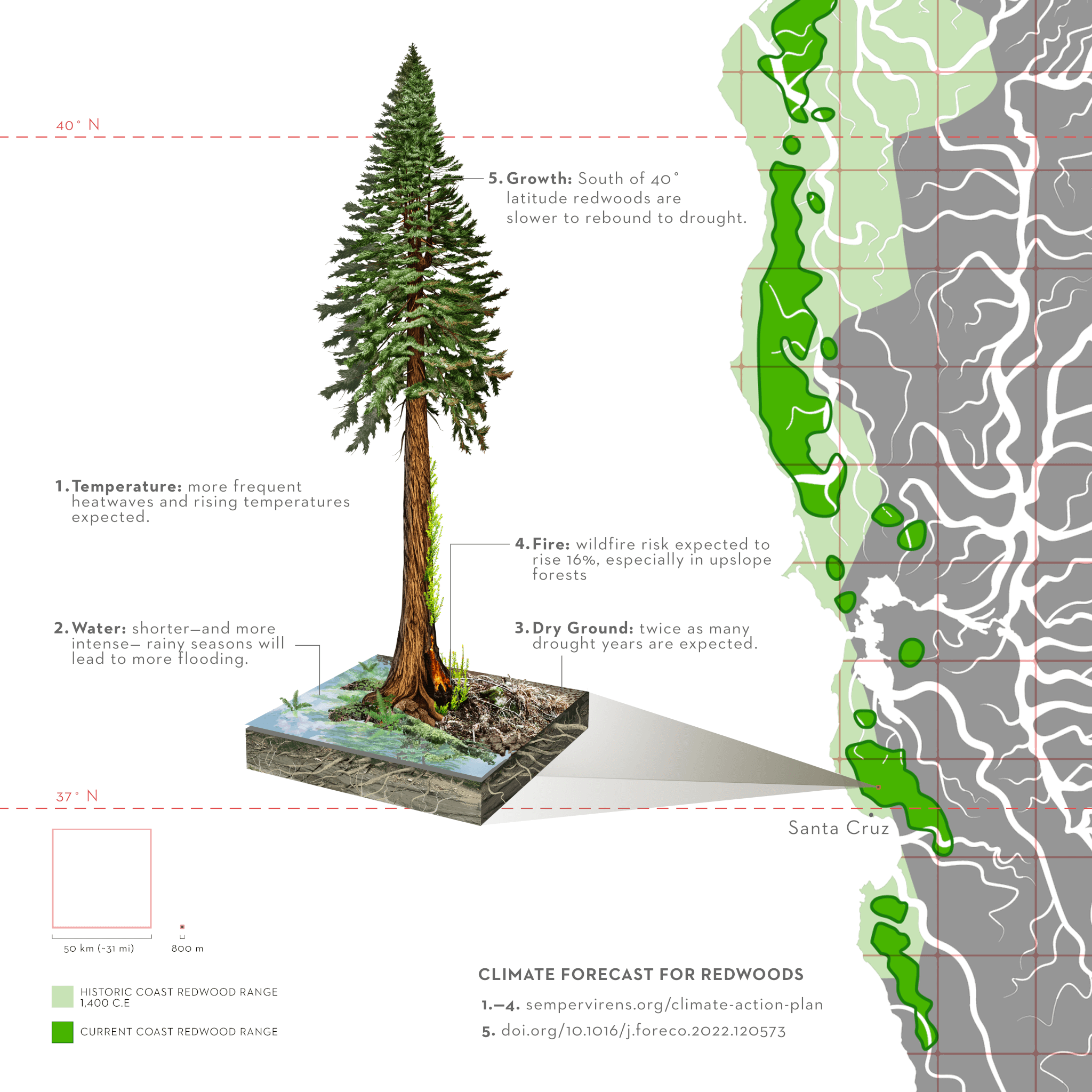
Climate Forecast for Redwoods illustration, by Jane Kim, Ink Dwell Studio
To respond to the rising threats to redwoods, and the natural and human communities that share their habitat throughout the region, Sempervirens Fund is sharpening its conservation strategy to focus more squarely on climate resiliency and redwood survival. In its recently published Climate Action Plan, the organization explains how the region’s redwoods might respond to the best available predictions for climate change to come: deeper droughts and rising temperatures are already causing trees physiological stress, slowing their growth, and making them more vulnerable to disease, disturbance, and fire. As for precipitation, some climate models predict longer annual dry spells and more powerful winter storms. That could mean more flooding, which might wash away the roots of heat- and drought-stressed trees, and less-reliable water availability throughout the growing season.
Since 1900, Sempervirens Fund has protected 36,000 acres of threatened redwoods throughout the Santa Cruz mountains. Now, McLendon says, the organization is doubling down on efforts to ensure that those protected forests have the best shot at withstanding the changes to come, while effectively prioritizing conservation opportunities for the thousands of acres that remain vulnerable throughout the region.
What do those commitments mean in practice? And what data and research are available to guide decision-makers at Sempervirens Fund and their partners throughout the region?
“Water is this species’ Achilles’ heel.”
Redwoods are a remarkably resilient species. Their thick, spongy bark insulates the wood within from flames, and they harbor the rare ability to resprout limbs and leaves after fire. The trees also secrete chemicals that resist insects, fungus, and rot. These are a few of the characteristics that can keep an individual redwood in the Santa Cruz mountains standing—and even gaining mass—for well over a thousand years, while generations of Douglas firs, oaks, and bay laurels grow up and die off.
But there’s a reason it’s hard to find redwoods more than fifty miles inland from the relatively wet, temperate coast of Northern and Central California. As Anthony Ambrose, a redwood ecologist with the forest research nonprofit, the Marmot Society, said in Part 2 of this series, “Water is this species’ Achilles’ heel.”
So, perhaps it’s no surprise that recent research reveals the toll that drought has taken on California’s redwoods in the recent past. In a 2022 study published in Forest Ecology and Management, Cal Poly Humboldt redwood ecologist Steve Sillett measured the recent growth rates of 235 trees in 45 groves, scattered evenly across the species’ range. (Read more here about how Sillett and his coauthors gathered all this data, and how his colleague Allison Carroll finally cracked the mystery of reading redwood tree rings for information about their past growth.) Then they rounded up data on three climate variables across each of the 45 sites: rainfall, minimum temperature, and maximum temperature. Next, they combined those three variables to calculate a fourth: the standardized precipitation evapotranspiration index, or SPEI. This methodology, developed by Spanish climate scientists between 2010 and 2014, essentially describes the relative severity of drought conditions at a given site and time, compared to historical baseline conditions.
The researchers determined that this fourth variable, SPEI, was most closely correlated with changes in redwood growth rates, and that trees further south in the range responded more drastically—that is, grew less biomass—during droughts than trees further north. “Sequoia trees north of 40° were least sensitive to drought, producing similar biomass annually during dry and wet years, whereas trees farther south produced less biomass during individual drought years,” they found. It wasn’t until the fourth year of the drought that gripped California from 2011-2015 that forests north of 40°—roughly the Mendocino/Humboldt county line—lost much momentum. And after two years of closer-to-normal rainfall, most of these northern forests returned to their expected growth rates.
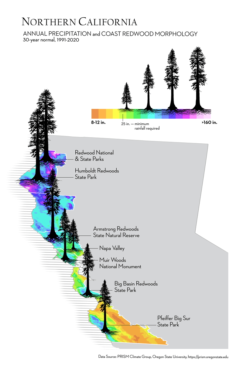
illustration by Jane Kim, Ink Dwell Studio
But south of Humboldt, researchers found that redwoods’ growth rates were more closely correlated with drought throughout the growing season. Forests in Mendocino, Sonoma, and throughout most of the Bay Area rebounded once the rains returned in 2016. But south of 37°, just about the latitude of Santa Cruz, trees didn’t seem to rebound from the drought, even in the historically rainy winter of 2017. “This is our wake-up call for redwoods at the southern end of their range,” said McLendon. “At a time when we need more redwoods growing bigger, faster—for their own health and also to maximize carbon storage—they are lagging, at best, and that’s troubling. We needed new strategies to protect redwoods, but as importantly, we needed to think about how to actively manage redwood forests to improve their growth and long-term survival.”
“We needed to think about how to actively manage redwood forests to improve their growth and long-term survival.”
—Laura McLendon, Director of Land Conservation
Deciding What To Save
The first priority in Sempervirens Fund’s Climate Action Plan is to protect land for redwoods to survive now and thrive in the long run. But as climate conditions rapidly shift throughout the region, how does the organization know that the lands it’s protecting today will still be able to support redwoods in the future?
Part 1 of this series explored how the climate models issued by authorities like the Intergovernmental Panel on Climate Change are too coarse to capture the abrupt changes in temperature and moisture from coast to inland that define the redwood range. In global climate models, “one pixel—one data point—is like 50 kilometers wide,” said Miguel Fernandez, a researcher with the German Centre for Integrative Biodiversity Research. That’s roughly the same width as the entire range of the redwoods from west to east, meaning the best global models we have basically blink and miss the great variety that makes up the redwood ecosystem.
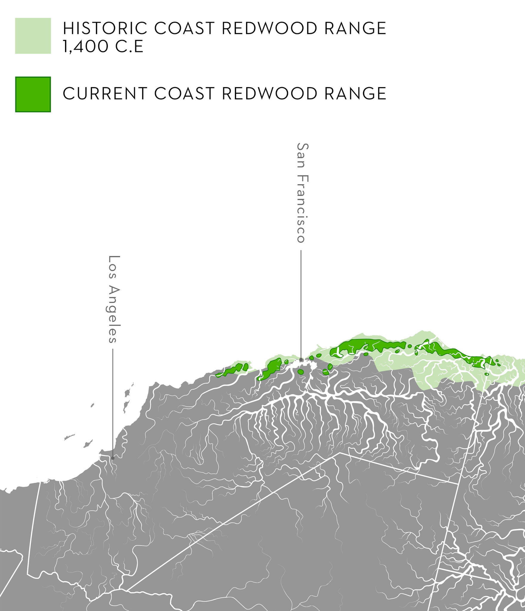
by Jane Kim, Ink Dwell Studio
In a 2015 paper, Fernandez sought to rectify this resolution problem. He used data from unusually hot or dry years in the past century as the basis for projections of how temperature and moisture might change within the redwood’s present range in the decades to come. His analysis zoomed way in from the scale of global climate models, splitting the redwoods’ present-day range into 800-meter pixels. Under the likeliest global climate scenarios for the middle of the century, Fernandez’s models showed that, by mid-century, the range of suitable habitat for redwoods could contract by 50 percent at its southern end, “with no suitable bioclimate remaining south of San Francisco Bay.” Fernandez’s research garnered lots of headlines when it was published (“Future coastal climate not cool for redwood forests”) and remains one of the few scientific studies that have ventured specific predictions about how predicted climate changes at the 50-kilometer scale translate to conditions we might start to see in the forests we know and love in the years to come.
Another factor that complicates the effort to predict how redwood habitat will shift in the future: the species’ range is defined by not only an overall sharp temperature and moisture gradient between the coastal and inland edges of its overall range, but also by the sort of abrupt, mountainous topography that makes for a great variety of microclimates and big differences in water availability over very short distances. “One challenge to that coarse-resolution data is the fact that conditions can vary a lot, even within an 800-by-800-meter pixel,” says Emily Francis, a research assistant professor of biology at the University of New Mexico. And since redwoods tend to grow only in areas where they get moisture year-round—whether from rainfall, fog, or perennial creeks and springs—even the relatively detailed 800-meter pixels Fernandez used to analyze the species’ range can’t capture enough detail to represent this complexity. (Francis notes that 800-meter pixels are a fairly standard size for researchers analyzing vegetation patterns across a broad landscape.)
So, Francis led a series of studies that attempted to account for the variations in redwood habitat suitability produced by hyper-local gradients in moisture availability, temperature, and fog. Francis and her coauthors gathered data across 86,000 acres in three well-loved redwood forests: Big Basin Redwoods State Park, Muir Woods National Monument in Marin County, and Jackson State Demonstration Forest in Mendocino County. They consulted existing maps and data on species occurrence and climate for these forests, but couldn’t find anything detailed enough to represent the true diversity of a patch of redwood habitat. So, they turned to emerging imaging technology to create maps of their own.
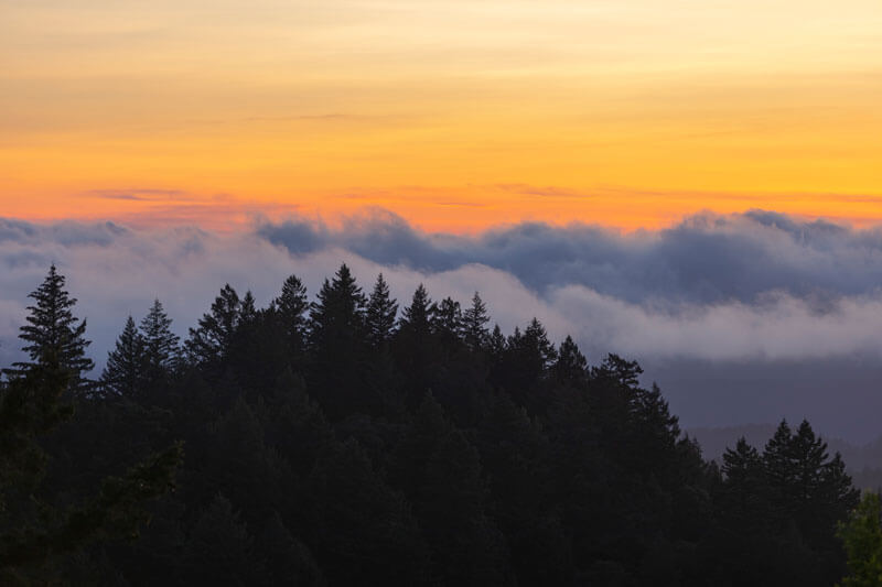
Sunset behind a blanket of fog below a forested ridge at Castle Rock State Park, by 7Roots Creative
Francis commissioned the Global Airborne Observatory (GAO), a plane loaded with what its operators call “the most advanced mapping technology operating in the civil sector today.” Flying low transects over each forest, the plane gathered data through two different instruments: a Visible-to-Shortwave Imaging Spectrometer (VSWIR) and a dual-channel LiDAR sensor. The LiDAR sensor shoots laser beams at the surface, which can both perceive and see through vegetation to piece together a high-resolution topographic map.
The imaging spectrometer, Francis explains, works something like a camera: “Your iPhone camera will show you the light an object is reflecting in the visible parts of the electromagnetic spectrum.” What our camera rolls show as blue, red, green, and yellow all correspond to different wavelengths of light; the typical human eye can detect wavelengths between 380 and 700 nanometers. An imaging spectrometer captures those wavelengths, but also near-infrared light (wavelengths from 800 to 2,500 nm) and shortwave infrared (wavelengths between 1,100 and 3,000 nanometers). “Those parts are parts of the spectrum where plant species express a lot of variability, depending on their leaf chemistry,” Francis explains. In other words, each species in the forest has its own “spectral” signature: a unique pattern of reflectance across the electromagnetic spectrum. The imaging spectrometer can detect these signatures for individual trees.
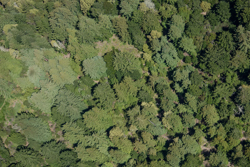
The various shades of trees in a forest in the Santa Cruz Mountains, photo by Ian Bornarth.
But the study wasn’t all laser beams and aeronautics. To “train” her data-generated maps to know what species reflects what wavelength, Francis headed out on a few good, old-fashioned site visits. In the forests, she marked the precise locations of over 600 trees, about half of which were redwoods, across the three study sites. She then fed that information back into the model, to correlate each species of tree to its signature wavelength across the entire study area. Then, she compared maps generated by the model to the data she had gathered in the field, assessing how accurately the model labeled the pixels she knew contained redwoods. “The overall accuracy at Big Basin was 98%, at Muir Woods, it was 96%, and at Jackson, it was 90%,” Francis says. (She suspects the accuracy at Jackson is lower because, with its recent history of logging, its trees tend to be smaller. So, the odds of a “mixed pixel,” containing two or more species, are higher.)
Altogether, Francis’s methods proved that it’s possible to efficiently generate maps of redwood forests across a broad area at an unprecedented level of detail: compared to the 800-meter standard for vegetation and downscaled climate modeling data, Francis’s maps offer a pixel size of just ten meters. “Our resulting high-resolution mapping approach will facilitate improved research, conservation, and management of redwood trees in California,” Francis and her coauthors concluded in a 2019 paper about the map-generating process.
But the species occurrence maps themselves only go so far to help resource managers understand the specific conditions in each grove that make some areas more suitable to redwoods than others. So, in a subsequent paper, published in 2020 in the journal Ecography, Francis layered in a bunch of existing data on fog, precipitation, and soil type, with maps of topography generated from the GAO—including the distance each identified redwood stood from a stream, and the average amount of sunlight that hits a particular spot, based on its aspect and slope. “The goal was to develop new maps of habitat suitability,” which is basically the likelihood that a redwood will be able to survive at all stages of its life cycle in a given spot, “and use them to try to test the hypothesis that habitat suitability varies at finer spatial scales” than most current analyses allow for, Francis says.
“The analysis we did suggests that variation in access to moisture, even across tens of meters, does influence the distribution of redwoods,” Francis says. The results weren’t exactly a surprise: “That’s probably pretty easy to infer if you’ve ever gone on a hike in a redwood forest. I think most people would notice that redwoods grow better closer to streams than up on ridges. But with this study, we had a very large data set to quantify that effect in ways that hadn’t been possible before because that high-resolution data wasn’t available.”
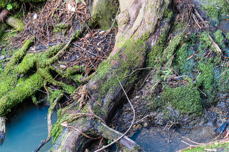
Redwood roots in McCormick Creek at Camp Jones Gulch, photo by Orenda Randuch.
As to why that’s useful, Francis mentioned the headline-grabbing conclusion from Fernandez’s 2015 study: “Using 800-meter resolution data, they found that, by the year 2030, areas south of San Francisco were most likely to become unsuitable habitat for redwoods. That includes all of Big Basin,” Francis says. Her findings suggest that, with adequately detailed data, resource managers can identify pockets of habitat, say, a cool nook down in a creek bed, where redwoods can continue to thrive, even if their neighbors on a sunny ridge nearby wither in the heat or burn away. For organizations like Sempervirens Fund, “the results suggest that it’s still worth it to invest in those areas that look like they might become unsuitable at lower resolution, because they might have these areas, called microrefugia, that actually are great habitat still.”
And Francis contends that there’s plenty of utility in the coarser data that most resource managers have access to. “These lower-resolution analyses can better cover the entire redwood distribution and tell us at a broad scale where climate is becoming unfavorable for redwoods,” she says. “That’s definitely useful information for considering how to manage redwood forests for climate change, and our study doesn’t do that.” Her 2020 study also didn’t attempt any specific predictions about how the present-day habitat suitability she’d mapped could change in the coming decades. “I do think it’s possible, and that’s definitely the next step here,” she says. “But there is a step of translating the variables that are output from a climate model, like temperature and precipitation, into the variables that we know are important to redwoods, like moisture availability, which depends on things like fog and topography.”
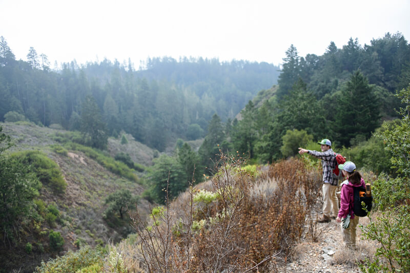
Land Team members monitor a protected property, photo by Russell Ferretti-Hoyle.
Back in 2013, Sempervirens Fund developed what it calls the Conceptual Area Protection Plan, or CAPP. This is a digital application that draws on a wide range of geospatial data, including a parcel’s biodiversity, proximity to other protected lands, forest size and condition, and watershed integrity, to prioritize opportunities for land protection and stewardship.
McLendon says Sempervirens Fund continues to update its CAPP with new data, including a recently released database from The Nature Conservancy that identifies locations estimated to harbor the greatest resilience to climate change. McLendon says the CAPP is a useful tool to evaluate potential land conservation opportunities before a site visit and to help maintain a list of priority properties that the organization hopes to protect. But data alone is only part of the story.
“We weigh the data with: What are the practical opportunities that we actually have? We may identify a property as a high conservation priority, but what if the landowner doesn’t want to sell? That’s why we put a lot of effort into cultivating relationships with landowners in the region, so, if and when they decide to sell, they come to us first.”
Forest Stewardship For A Changing Climate
“A lot of our project prioritization, both in acquisition and stewardship, has really shifted since the 2020 CZU wildfires,” McLendon says. She’s encouraged by the ubiquitous sight of redwoods that survived and are resprouting with new growth: “It’s definitely a forest in recovery, but it’s a forest system forever changed,” McLendon says.
Executive Director Sara Barth and Director of Land Conservation Laura McLendon with the redwood tree called "Father of the Forest" in Big Basin Redwoods State Park on September 10, 2020—just weeks after the CZU Fire— photo by Ian Bornarth, and the "Father of the Forest" on April 4, 2023, photo by Orenda Randuch.
Before the fire, land managers throughout the region recognized that many of its forests were choked with flammable debris after more than a hundred years of routine fire suppression, and a legacy of clear-cut logging left vast swathes of dense, crowded forests. But resources for forest management have long been inadequate: In Part 3 of this series, Sempervirens Fund Executive Director Sara Barth explained how, prior to 2020, California State Parks’ controlled burn program at Big Basin was “relatively aggressive” and “way beyond the average level for state parks, and for most other landowners in the region.” Those areas that they’d managed to treat with low-intensity fire seem to have fared better during the big blaze than areas that hadn’t burned, Barth says. But owing to cost, regulations, liability, and a narrow and unpredictable window of acceptable weather conditions for setting management fires, the agency only ever managed to burn what Barth calls a “tiny fraction” of the park’s overall area.
The experience of living through the fire—and seeing the profusion of green growth that’s sprouted from blackened stumps—has galvanized Sempervirens Fund and fellow conservationists throughout the state to focus more energy and resources on managing forests to make them more resilient to fire and other disturbances.
“Going forward, we aim to balance more of our work around proactive restoration, including vegetation management activities like removing shrubs and low plants,” McLendon says. And thinning has benefits beyond creating a more fire-resilient forest: It also allows other important species that share redwood habitat a chance to grow and thrive. On a 107-acre property adjacent to Castle Rock State Park that Sempervirens Fund protected in 2010, the organization studied the ecological effects of such thinning treatments and found that “biodiversity on the forest floor was far greater in areas that were thinned, compared to areas that were not treated,” McLendon says. “Not only the number of plants overall, but the number of different species were far greater in areas that were treated, and that’s just what we’ve seen in the first ten years.”
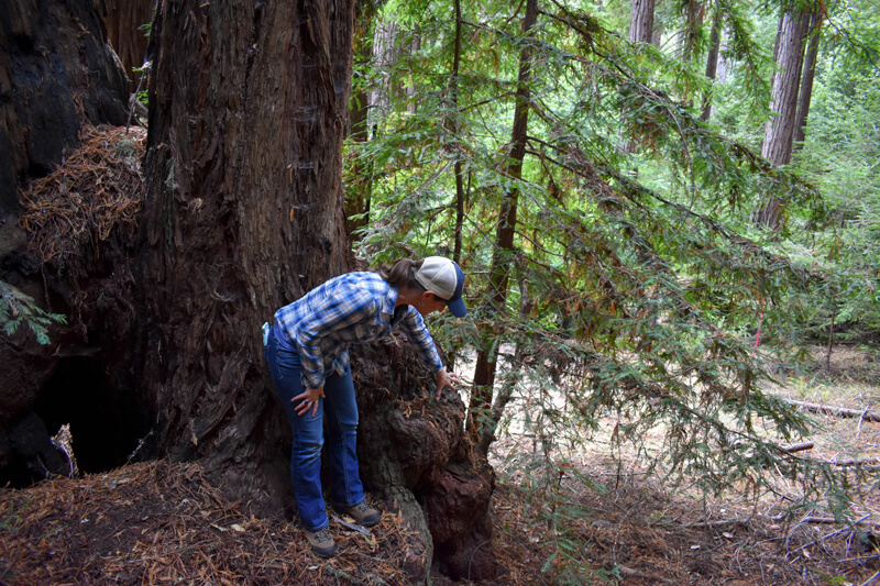
Laura McLendon checks on a complex old-growth near Castle Rock, photo by A. Blanchard.
The organization is also committed to “reintroducing prescribed fire, which is a low-intensity type of fire that adds nutrients to soil, promotes biodiversity, and lowers the likelihood of future catastrophic fire” by consuming debris before it has the chance to build to hazardous levels, McLendon says.
But how do McLendon and her colleagues know—across the 224,000-acre region in the Santa Cruz mountains, where the organization has focused most of its work—what areas are most in need of restoration forestry?
Following the CZU fires, the organization added to its CAPP a new data lens through which to view the landscape, which McLendon calls “stewardship need.” “Post-fire, a lot of areas were shown to have burned at a pretty high severity,” McLendon says. “That’s left just an insane number of dead and dying trees on the ground,” leaving hazardous conditions for future fire seasons. These areas would benefit from either a controlled burn, which would consume the debris, or having crews come through and chip up or haul out the dead and downed trees. The new “stewardship need” data layer combines information on fire severity with considerations like parcel size, access, and slope, to help pinpoint the areas where restoration is both feasible and most urgent.
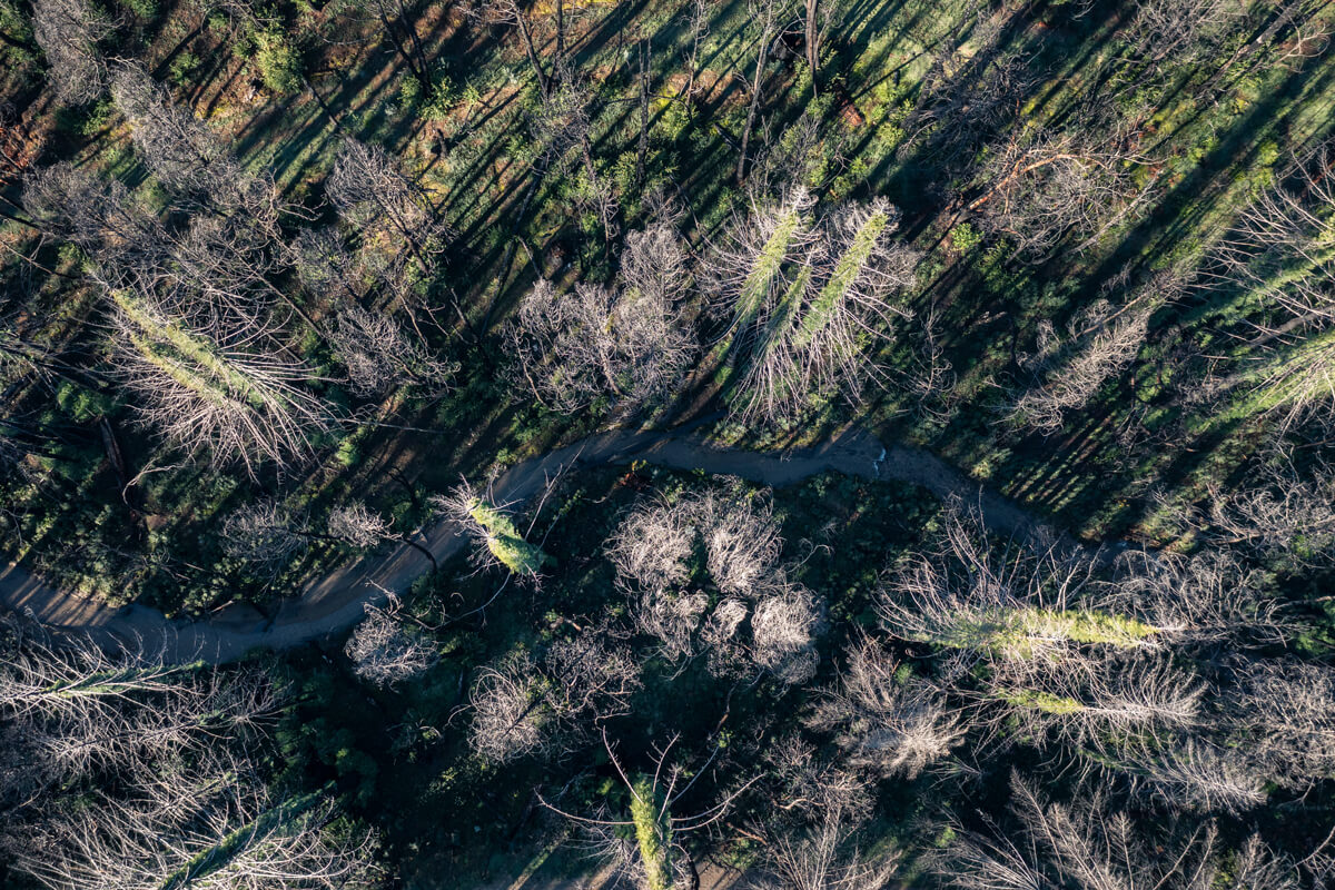
Fuzzy green growth on redwoods recovering along a creek at San Vicente Redwoods, photo by Teddy Miller.
San Vicente Redwoods: A Living Laboratory
One place where Sempervirens Fund is test-driving its climate-responsive forest stewardship goals is the 9,000-acre San Vicente Redwoods, which the organization and its partners acquired from a cement manufacturing company in 2011. The forest is a vast patchwork of old-growth and previously logged areas, crossed by eight creeks, and home to important and threatened wildlife, including marbled murrelets, coho salmon, and California red-legged frogs, as well as rare plants, such as the Point Reyes horkelia and Santa Cruz manzanita.
In a highly anticipated milestone for local hikers and mountain bikers, the Land Trust of Santa Cruz County opened the first seven miles of an eventual 38-mile public trail network at San Vicente Redwoods in December. Meanwhile, since its protection in 2011, Sempervirens Fund, Peninsula Open Space Trust, and Save the Redwoods League have carried on the ambitious work of restoring ecological health and function after over a century of interruption from logging, road building, quarrying, and fire suppression.
Endangered coho salmon and steelhead trout fry at San Vicente Redwoods, by Melisa Cambron Perez.
Stewardship corps members from the Amah Mutsun Land Trust have helped thin dense thickets of debris and, with Cal Fire, have reintroduced controlled fire along Empire Grade Road. To help slow the spread of fast-moving wildfires, crews have cut 11 miles of shaded fuel breaks along roads and ridges and have thinned, or have plans to thin, 500 acres throughout the forest. Last year, the partners planted 23,000 redwood seedlings and 900 Douglas firs in areas burned by the CZU fires. Over three years, Sempervirens Fund helped remove invasive clematis vines from creek beds throughout the property. And in 2021, the organization removed a dam that had long blocked salmon from swimming to spawning grounds upstream. Less than a year later, in September 2022, scientists documented the first-ever coho salmon, a federally endangered species, above the former site of the dam.
All these projects support the overall goal at San Vicente of protecting and enhancing existing old growth, while restoring what McLendon calls “old-growth conditions” to previously logged areas of the forest. But what are those conditions, and why the focus on old growth for climate-conscious restoration?
For one thing, older redwoods are more resilient than younger trees to the kinds of challenges the forests will face in a warmer future: more fire, wind, storms, and flooding, McLendon explains. The recently published research from Cal Poly Humboldt redwoods expert Steve Sillett and his coauthors also finds that older redwoods foster more biodiversity than younger ones, and produce more decay-resistant heartwood, which makes them more efficient at storing carbon that would otherwise be released into the atmosphere to contribute to global warming. And, unlike most other tree species, whose growth tends to slow as they age, redwoods keep adding enormous—and increasing—amounts of wood as they age.
“When it comes to carbon storage potential, there is no other tree that does it as well as an old-growth redwood,” McLendon says, echoing the consequential findings of groundbreaking research from Sillett’s lab that were published in the journal Forest Ecology and Management in 2020. In their 2022 study on redwood growth efficiency, Sillett and his coauthors attribute some of the difference in carbon storage capacity between primary (old-growth) and secondary (previously logged) forests to chemical changes throughout a redwood’s lifespan. Wood extracted from trees growing in primary forests was found to have three times more fungus- and pest-resistant chemicals than trees in secondary forests. As a result, older trees add wood more slowly than younger trees, as they shift the balance of their energy from growth to longevity.
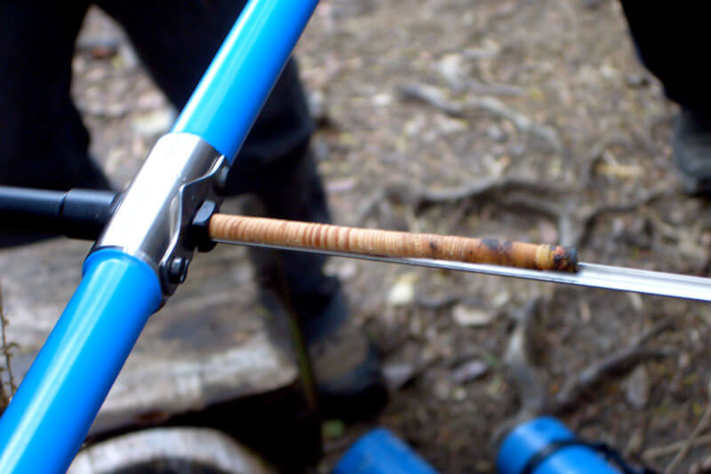
A tree core sample, by Vanessa Bertozzi.
“The decay resistance of heartwood may increase during Sequoia development with profound implications for management of non-timber values, especially carbon sequestration and biodiversity,” researchers wrote. In other words, since older trees resist decay better than younger trees, old-growth groves are a better bet for long-term carbon storage. “Its potential to store the most carbon per acre of any forest type in the world is why we elevate the protection of old-growth redwoods,” says McLendon.
As for biodiversity, older trees are more structurally complex than younger ones: They’ve had time to grow limbs that are themselves the size of mature trees, and develop the massive, multi-layered crowns that are home to a whole strange community of plants and animals that thrive hundreds of feet above the forest floor: lichens, ferns, shrubs, berry bushes, heath, and even Douglas firs and pines.
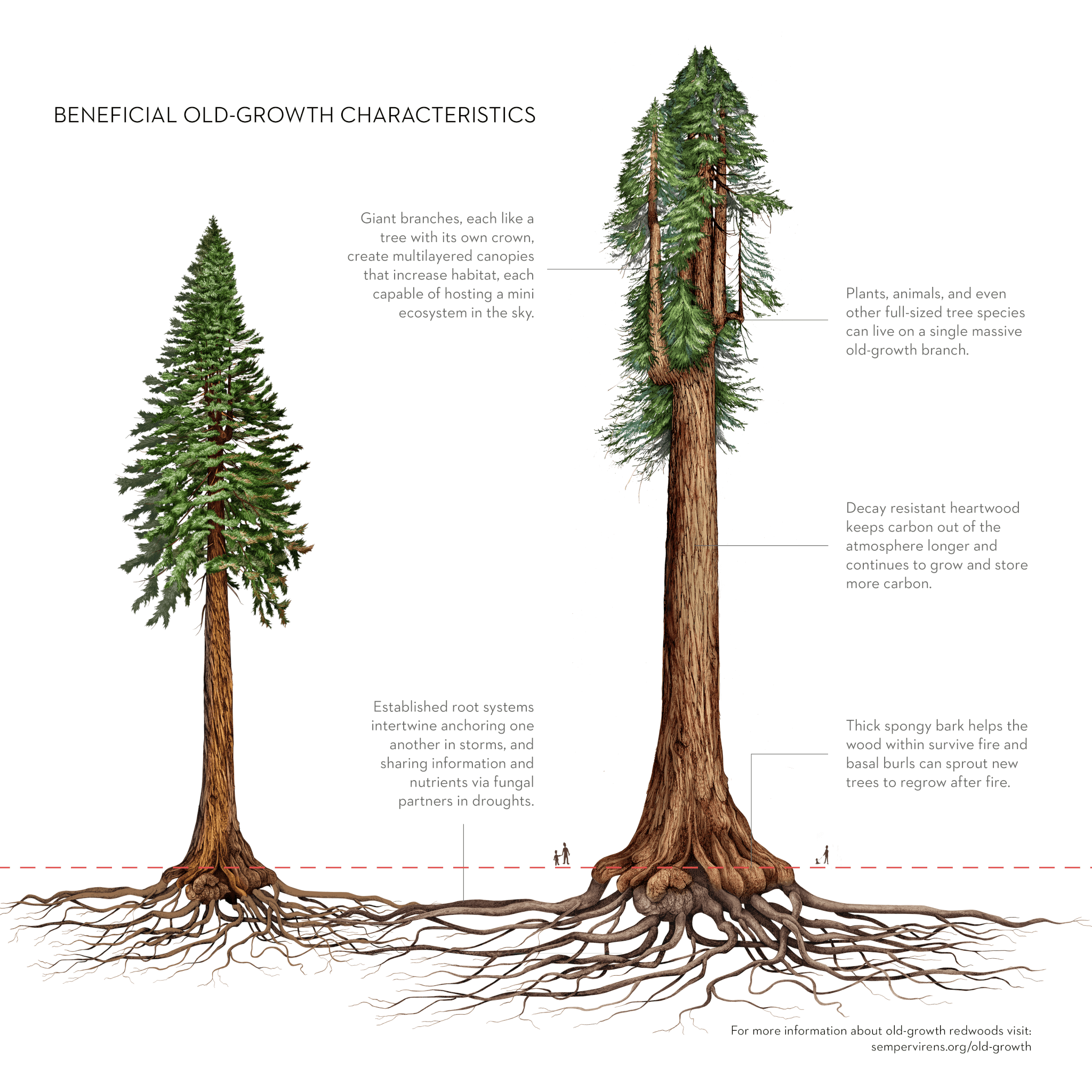
illustration by Jane Kim, Ink Dwell.
Yet today, just 5% of remaining redwoods are in stands that have never been logged. (Of the 10,000 acres of old growth in the Santa Cruz Mountains, about a thousand acres are unprotected—and these thousand acres are Sempervirens Fund’s highest priority for protection in the region.) If left to their own devices, most of the other 95% might eventually regain some of these old-growth characteristics, but that process could take hundreds of years. With help from foresters, that process can be sped along, McLendon explains.
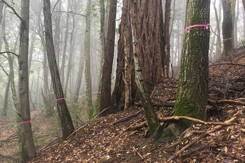
Trees with pink ribbon can be removed so the redwood in the center can grow faster, by Neal Sharma
The idea is to pick a few trees in each grove of previously logged forests and designate them as what McLendon calls “candidate old-growth” trees. Those trees get to stay and keep growing thicker bark, more resistant heartwood, and bigger arms to support more biodiversity in the forest canopy, while many of the surrounding redwoods may be cut down for use as commercial timber, a source of revenue to fund ongoing forest restoration and management. In their 2022 article, Sillett and his co-authors describe this style of restoration forestry as the Potential Elder Tree model, and stress that it could have benefits for managed forests of all types, as old-growth forests are in decline globally. “Promoting and retaining at least a few large trees per hectare can make substantial contributions to forest biodiversity,” they argue. This sort of selective harvest can generate income from timber sales that can be reinvested in forest restoration. And it’s been shown to have huge ecological payoffs: “Not surprisingly, when you do take out some of the competing trees, the ones you leave behind get bigger, faster,” McLendon explains.
“The strategy we’re pursuing at San Vicente Redwoods and many other places where we work is not only to protect those existing groves, but to knit them together through restoration practices by encouraging acceleration of growth in second-growth forests,” McLendon says. “The goal is to have larger continuous old-growth stands. It’ll take a few generations to get there, obviously, but when we’re thinking about massive climate systems and trees with massive lifespans, we think long-term.”
A Plan For Urgent Action To Save Redwoods
All told, the threats facing the region’s redwoods—and the natural and human communities that share their habitat—are daunting, says Sara Barth. “But I know how hard we’re all working to help this species endure, and I’ve seen the progress we’ve already made.” Barth says that the 36,000 acres of forest that generations of Sempervirens Fund supporters have helped protect and restore is just one measure of that progress. So is the network of nonprofits, government agencies, companies, and experts that Sempervirens Fund partners with, and the scientists whose findings are essential to understanding the complex interactions among climate, ecology, and biology that have shaped the forests we know today.
Still, Barth says that everyone who cares about the future of redwoods should be hearing alarm bells right now. The urgent need for action and investment on an unprecedented scale is why Sempervirens Fund is organizing its future work around three ambitious new goals. First, the organization will accelerate its purchasing of land for permanent conservation and protect 7,000 more acres of climate-resilient redwood forests by 2030. Second, through restoration and management, it aims to boost the ability of forests throughout the region to store carbon, capturing an additional 1.1 metric tons of carbon by 2050 that would otherwise contribute to global warming. Finally, Sempervirens Fund is pursuing partnerships and policies to ensure that the State of California meets its goal of protecting 30% of the state by 2030 (up from 24% protected today).
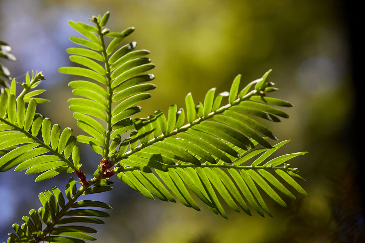
Redwood leaves remove carbon from the air and store it in the tree's wood, by Canopy Dynamics
To help reach these goals, Barth says, Sempervirens Fund is fighting for policies that support climate resilience. The organization advocated for $54 billion in state funding in 2022 to support conservation and protect public lands, parks, and coastline, statewide. And it’s working with lawmakers in Sacramento to restore the $1.3 billion for climate projects that was cut in Governor Newsom’s 2023 budget proposal. Public funding—local, state, and federal—will be key to preparing the state’s forests to withstand climate change. Policy working its way through the California Legislature would finally direct state agencies to prioritize acquisition of conserved lands, beginning in the Santa Cruz mountains—an approach not seen from state conservation agencies for much of the last decade.
But Barth says the most important factor in the organization’s success is the growing community of people who feel a personal connection to the region’s redwoods, and who have given their time, skills, and resources to Sempervirens Fund in return.
“So many of our supporters are keyed in to what’s happening with the region’s forests, and they’re the strongest force behind our goals and plans for the future,” says Barth. “The willingness and concern from our supporters and community to step up and meet this moment are what give me the most hope for the future.”
“The willingness and concern from our supporters and community to step up and meet this moment are what give me the most hope for the future.”
—Sara Barth, Executive Director
More to Explore
- Read our Climate Action Plan for Redwoods
- Watch Laura McLendon and Tom Robinson Under the Redwoods discussing new evidence about the climate crisis and how we're responding
- Read more about The Past, Present, and Future of Fire and Stewardship in Part 3 of Redwoods and Climate

